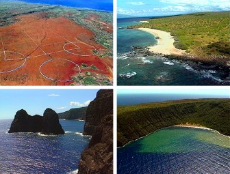
Recorded in March of 1988, this around-the-island aerial survey of Kaho‘olawe island documents both inland and shoreline areas.
Visible are bomb craters from years of military use, archaeological sites and soil erosion areas, in addition to white sand beaches and spectacular cliffs. No sound track. Place names are identified on screen.
Areas surveyed
Moa‘ula, Lua Keālia Lalo, Honokanaea, Kealaikahiki, Keana Keiki, Lae Paki, Honokoa, Ahupū, Kūheia, Keālia Luna, Hakioawa Iki, Hakioawa, ‘Oawawahie, Lae o ka Ule, Kanapou, Kamōhio, Pu‘u Koa‘e, Waikahalulu, Pu‘u Mōiwi
Also: bombing impact zone, Molokini island, Pu‘u‘ōla‘i (Maui)
1996
length: 1 hour, 30 minutes

